Geologists perplexed for decades: Mystery location revealed to have originated from a colossal flood event
================================================================================
In the heart of eastern Washington, a landscape of braided waterways, deep canyons, and colossal dry waterfalls has long puzzled geologists. This terrain, known as the Channeled Scablands, was carved by a series of catastrophic floods that occurred during the last ice age.
The story begins in 1909, when Harley Bretz, a high school science teacher, visited the University of Washington. A striking feature on a map caught his eye: Potholes Coulee, a huge cataract with no apparent source of water. Intrigued, Bretz started to piece together the puzzle of the scablands.
Two decades later, Bretz's research took a significant turn. He proposed that a massive ice-age flood had carved three parallel tracts of flood channels south of the Cordilleran ice sheet, pooled in a temporary lake, and drained into the Columbia River Gorge. This flood, Bretz argued, was the only possible explanation for the region's features.
Richard Waitt, a geologist with the USGS, further substantiated Bretz's theory in 1977. He discovered that there had been at least 40 ice-age floods in the scablands, each representing a separate flood event. Subsequent research indicates that as many as 80 floods ravaged the scablands near the end of the last ice age.
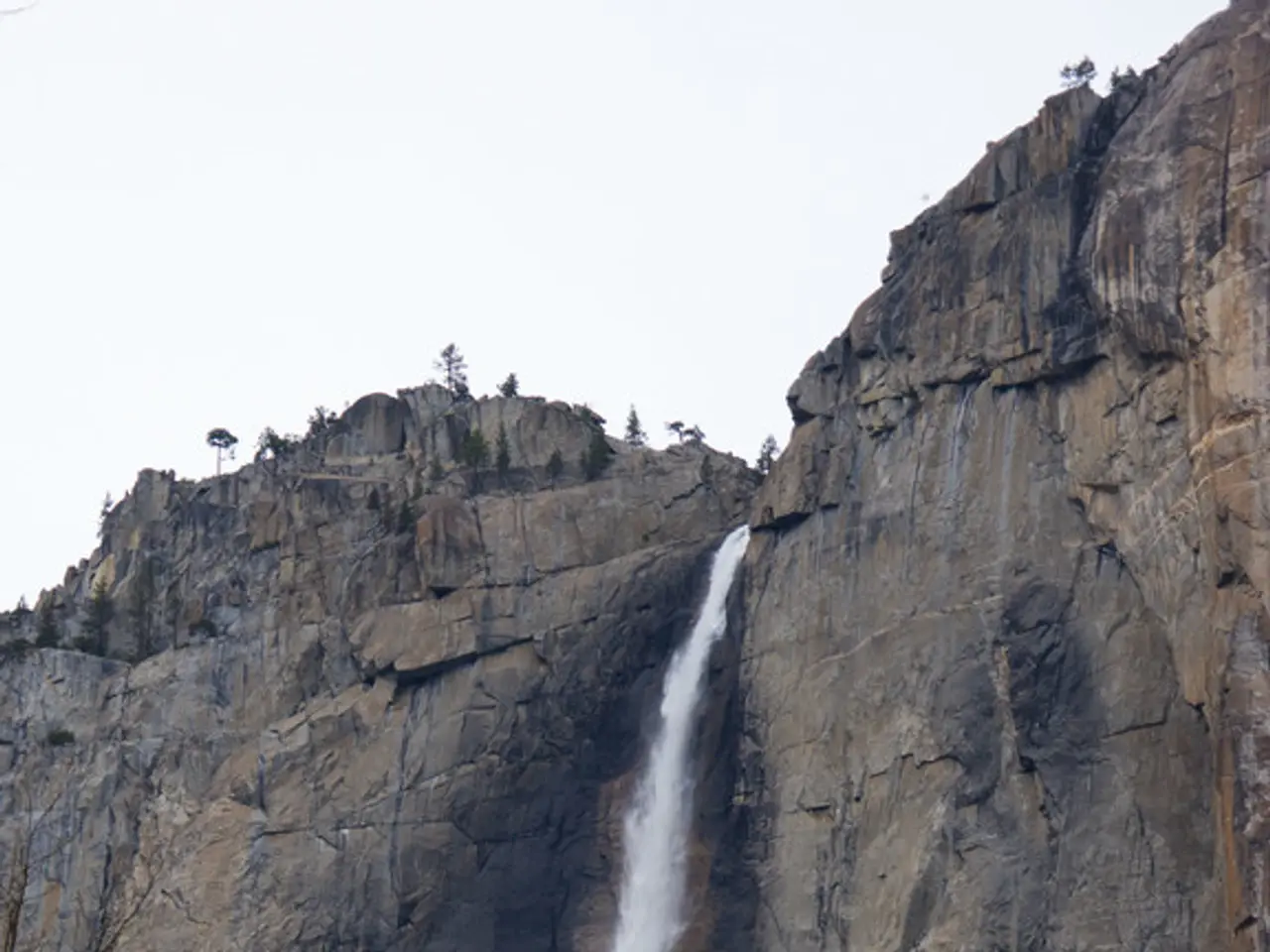
One of the most dramatic features of the scablands is Dry Falls, a dry waterfall three miles wide and 400 feet high—10 times the size of Niagara Falls. The floodwaters also carved the famous Grand Coulee, a canyon up to three miles wide with walls up to a thousand feet high.
The floodwaters unleashed during these events were truly epic. One flood, for instance, had a torrent of water with ten times the combined flow of all the world's rivers, reaching speeds approaching 80 miles per hour. If such a flood were to happen today, it would submerge most of Portland's skyline.
Despite the compelling evidence, Bretz's hypothesis was initially met with skepticism and criticism. It went against the long-held belief that geological change was gradual and uniform. Bretz faced resistance when he published his findings, with authorities in the field resisting his evidence and dismissing his arguments.
However, the scablands' enigma was eventually solved. Geologists found that the floods occurred repeatedly over a two- to three-thousand-year span ending roughly 13,000 years ago. The floods were caused by Glacial Lake Missoula, a giant ice-age lake that formed when the Cordilleran ice sheet progressed south and blocked the Clark Fork river valley, forming a dam of ice 2,000 feet high.
Today, the scablands of eastern Washington stand as a testament to the power of nature and the persistence of scientific inquiry. Hundreds of dry waterfalls, canyons, mounds of gravel, deep holes in the bedrock, and countless oddly placed boulders spread over 16,000 square miles, serving as a reminder of the catastrophic events that shaped this unique landscape.
Read also:
- Understanding Hemorrhagic Gastroenteritis: Key Facts
- Stopping Osteoporosis Treatment: Timeline Considerations
- Tobacco industry's suggested changes on a legislative modification are disregarded by health journalists
- Expanded Community Health Involvement by CK Birla Hospitals, Jaipur, Maintained Through Consistent Outreach Programs Across Rajasthan


